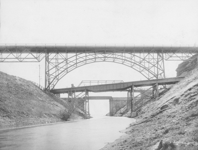
When a piece of infrastructure is no longer needed, sometimes it is dismantled, never to be seen again, and sometimes it is retired, abandoned in place, making future generations wonder what on earth it was ever used for. If you don’t recognize what’s in this photograph above from 1899 (image courtesy of the Hamilton Public Library, Local History & Archives), allow me to introduce you to the now-retired Desjardins Canal.
The history
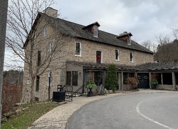
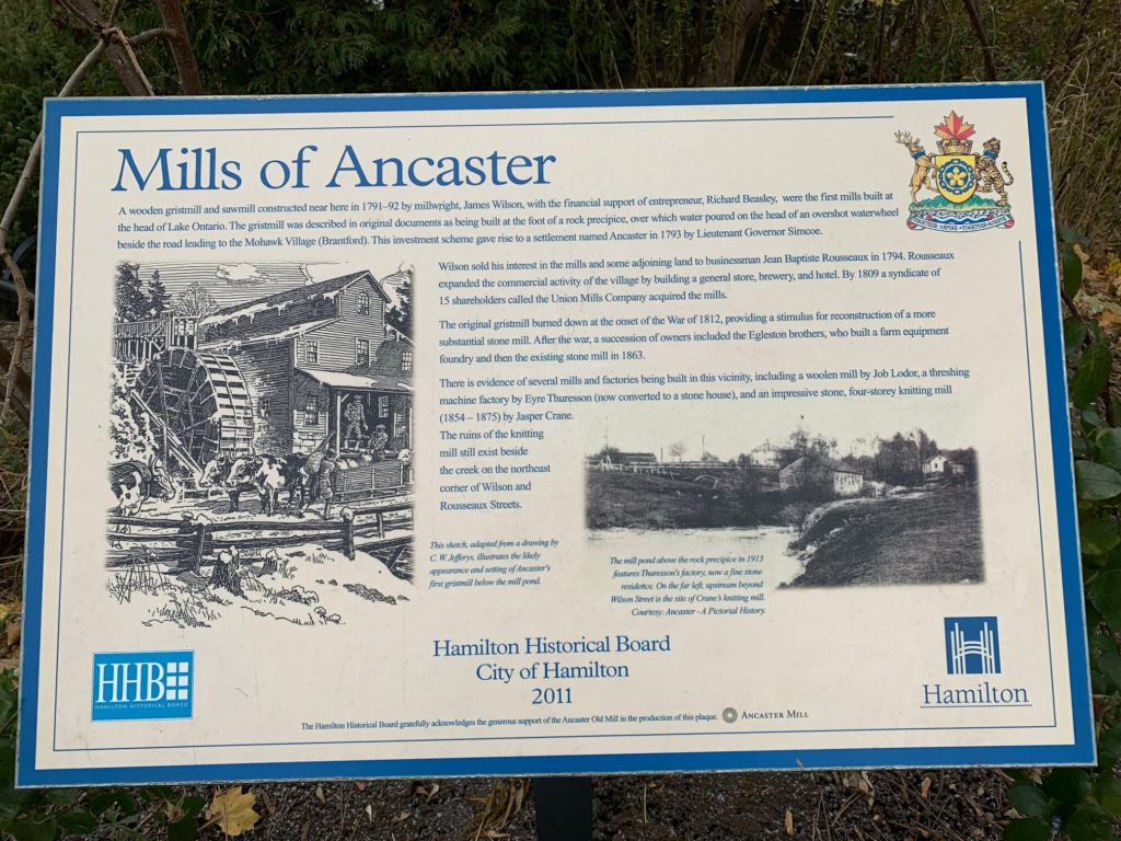
In the late 1790s, the creeks and waterfalls of the Dundas area west of Hamilton started to attract industry wanting to take advantage of the abundance of waterpower for manufacturing (paper mills, saw mills, woolen mills, flour mills…). “Dundas Mills,” as the town was known early on, soon had one of the highest concentrations of manufacturing mills in Canada (see Figure 1).
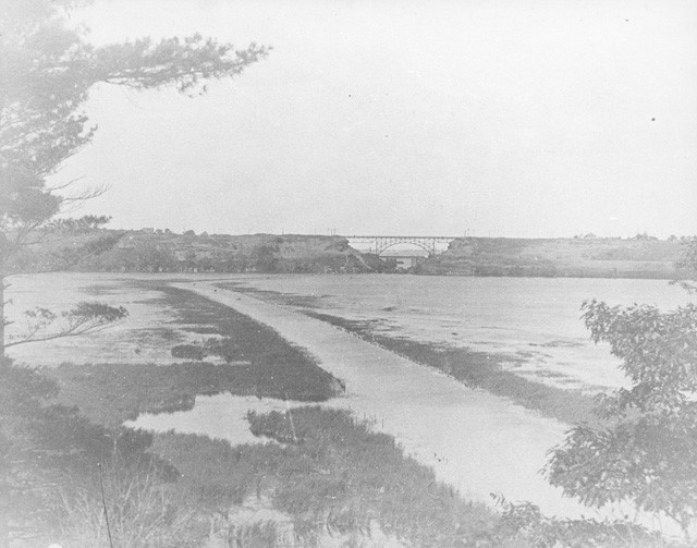
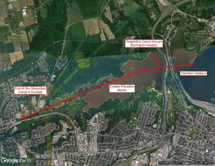
The one thing this industrious area lacked was water access to Lake Ontario for shipping goods produced in the area. In comes a French immigrant by the name of Pierre Desjardins, who pitches the concept of a canal to the governments of the region. It would connect Hamilton Harbour to Cootes Paradise Marsh (managed today by the Royal Botanical Gardens) and continue west, bringing boat access into downtown Dundas. Consuming most of Desjardins’ life to promote and fundraise, its construction would finally begin in 1827 and would be open for business 10 years later (see Figure 2 and 3).
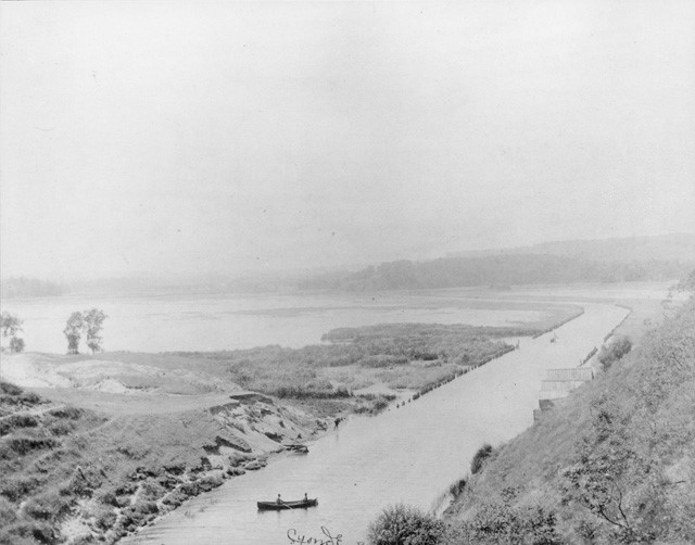

The canal was a technological achievement in construction at the time, excavating and establishing the waterways through the marsh to allow good-size ships access from Lake Ontario to the manufacturing mills. The total length of the canal was almost 5 km long, from Dundas to Hamilton Harbour, and it measured 60 ft wide and 9 ft deep (see Figure 4). Pierre Desjardins, however, never lived to see its completion, having died the year construction started under suspicious circumstances…

The Desjardins Canal remained in operation for only about 20 years until the railroads took over the business of moving goods, and the manufacturing centres moved to the waterfront in Hamilton.
The present
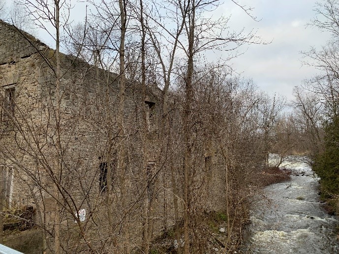
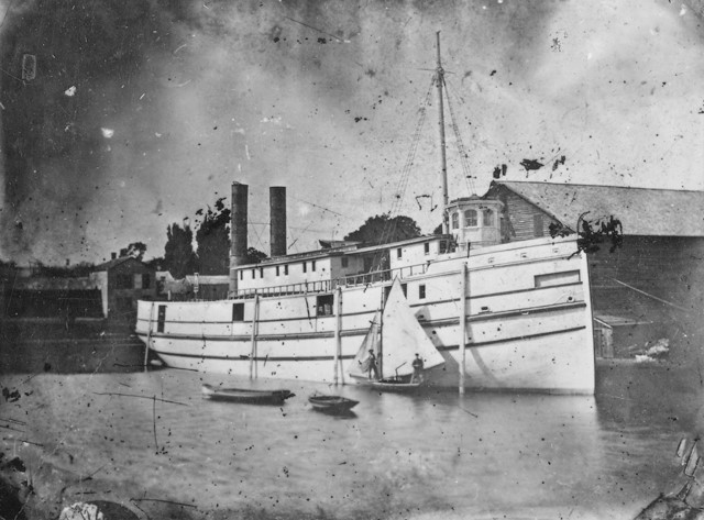
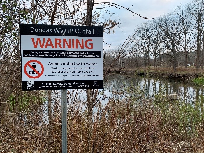
The really active years of the canal were prior to the 1850s. For this reason, photos of the larger cargo ships that apparently lined the canal in its busiest years are very hard to find (if not impossible). It eventually became the recreational waterway seen today, used only for pleasure rides as shown in Figure 2 above. Long since abandoned as a shipping channel, its presence is still easily visible (see Figures 5 and 6).


Once the maintenance dredging of the canal was stopped, most of its length filled in with sediment as the marsh slowly reclaimed it, erasing it from view. Left to their own fate without human intervention, navigation canals slowly fill up, reducing their ability to carry ships. They require regular maintenance and dredging since Mother Nature doesn’t build anything in straight lines or of uniform depth. The portion of the canal that was excavated upstream of the marsh (into the town of Dundas) still maintains its shape (see Figure 7).

Most of the marsh today is only a few feet deep. From a busy shipping channel to a recreational waterway, the Desjardins Canal has mostly returned to nature and to the community. Enjoy retirement!
Trivia
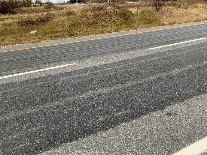
What is it that we spray on the highways before anticipated snow or freezing rain that leaves those streaks on the pavement?
Magnesium chloride and calcium chloride, when sprayed on pavement before a snowfall, prevents snow from sticking to the pavement, reducing the risk of ice forming. Similar to road salt, these chemicals are not good for cars. Keep your cars clean and your eyes on the road!

Have you seen an interesting building or piece of infrastructure in or around Burlington that you’d like Eric Chiasson, your personal engineer, to write about?
Send us your suggestions, comments, or questions to articles@local-news.ca and we’ll see what Eric can find out!
Sources:
Canadian Transport Sourcebook. High Level Bridge, Hamilton, Canada Postcard. Url: www.transportsourcebook.ca/imagepages/high_level_bridge_hamilton_canada_pc.php (accessed Nov 28, 2021).
Royal Botanical Gardens. The Fishway at Princess Point. Url: https://www.rbg.ca/plants-conservation/nature-sanctuaries/fishway/ (accessed Nov 28, 2021).
The Hamilton Spectator. June 23, 2017. The Frenchman’s Dream: A Water Route to Dundas. Url: https://www.thespec.com/news/2017/06/23/the-frenchman-s-dream-a-water-route-to-dundas.html (accessed Nov 28).
Hamilton Public Library. Online Images. Local History & Archives. URL: https://www.hpl.ca/articles/online-images (accessed Nov 28, 2021).
Hamilton Conservation Authority plaques:


For more information on the author: https://www.linkedin.com/in/eric-chiasson-10601082