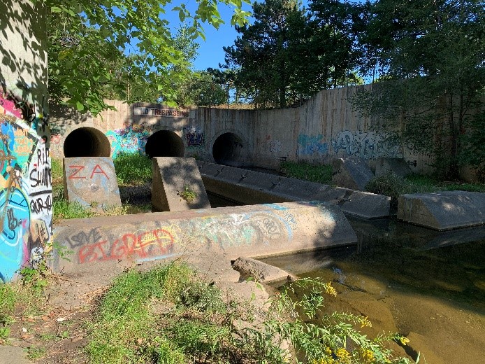
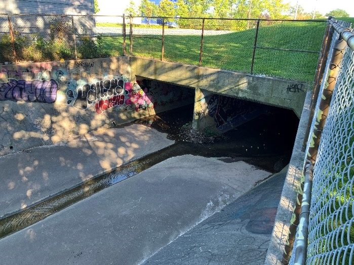
For those of you who live or work in the downtown Burlington area or who enjoy spending time there, you might be familiar with our quiet little creek that runs through the downtown neighborhoods, bringing plenty of small wildlife like foxes, possums, and countless birds and reptiles to our backyards — it goes by the name of Rambo Creek. Its headwaters come from north of the QEW, pass through several box culverts (see Fig. 4, left, for a photo of a box culvert) under the highway, and runs parallel to Brant Street on the east, zigzagging its way through town to Lake Ontario.
It wasn’t always a quiet little creek. There was a time a while back when it would overflow and sometimes flood during big rainfalls, eroding its banks and causing damage in the downtown area. In the 1990s, however, the Rambo Creek Diversion Channel and its associated flood control structures were built to stabilize the creek and protect downtown from flooding (Wood, 2020).
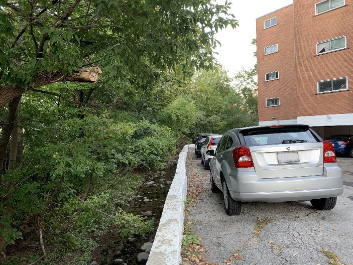
Over the past half century, Rambo Creek has been getting more crowded with urban development. Parking lots and buildings have been built up against it, and in some cases, right over it! A good portion of the creek is buried in box culverts, carrying its waters through town mostly unseen. Following it through town from Highway 403 all the way to its Lake Ontario outlet near Lakeshore Road and Torrance Street can be challenging because it moves sporadically from forested open creek beds to long underground culverts. It winds between apartment buildings and hides behind strip malls. In some locations, it meanders through residential backyards. If you’re close by and you pay attention, you’ll hear its natural sounds of running water.
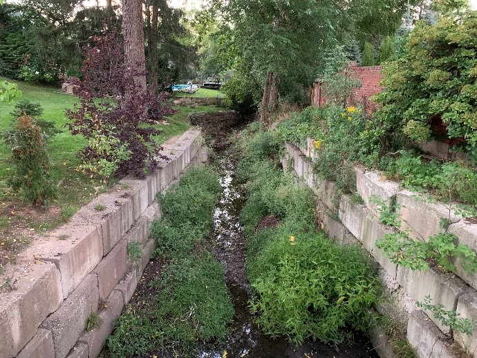
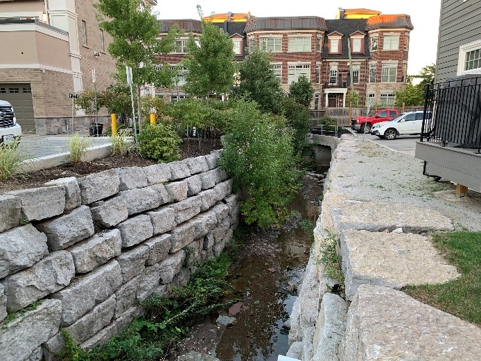
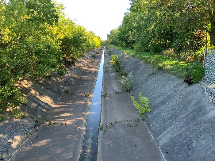
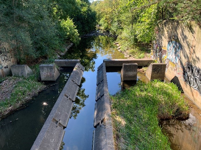
Over the years, attempts have been made to stabilize the creek bed by means of concrete retaining walls (see Fig. 3, left), gravity stone walls (see Fig. 2, right), boulders, and culverts, and all have been subject to significant maintenance and repairs, especially during rainy seasons. As much as we try to control water, its damaging effects through erosion are as inevitable as gravity. So, to mitigate the risk of flooding and damage to downtown infrastructure, a diversion channel was needed to control the volume of water going through Burlington’s historic neighborhoods, which was eventually built in the 1990s. The channel was funded by multiple levels of government and is maintained and operated by Conservation Halton to reduce the risk of local damage due to flooding (www.conservationhalton.ca/dams-and-channels).
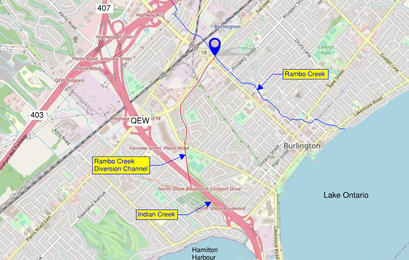
Before building the diversion channel, the natural and built environment had to be scrutinized to find the route that would be best in terms of optimizing flood reduction and minimizing construction impacts. The creek would need to be intercepted high enough upstream of the densely developed downtown area but low enough to maximize the flow reduction through town. Its starting point would be near the intersection of Fairview Street and Brant Street, and the water would be carried safely southwest to the Hamilton Harbour, thereby significantly reducing the volume of water going through downtown.
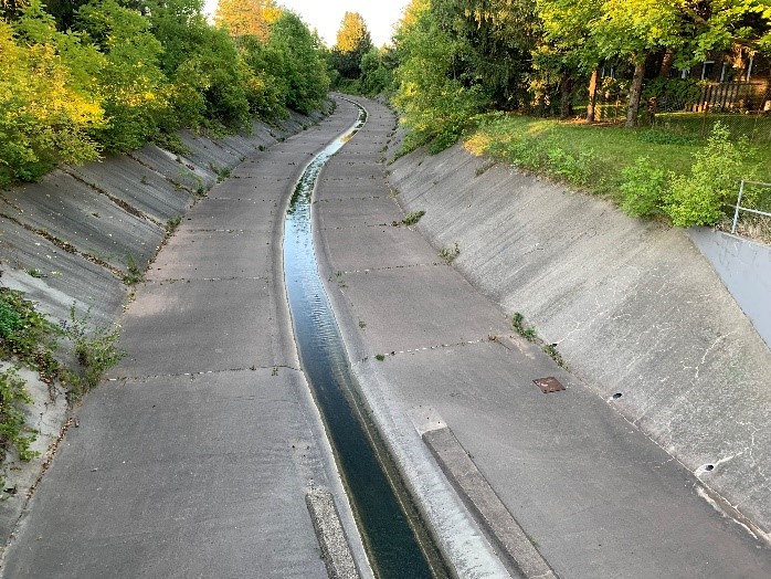
The diversion channel today consists of a long concrete paved channel, approximately 2.5 km long with steep slopes diverting flows from Rambo Creek itself, and running southwest, parallel to Fairview St. It then curves south through residential neighborhoods, under several roads, until it goes under Maple Avenue. This location is one of the best places to watch the channel in action after a big rainfall, with deep water being diverted from downtown.
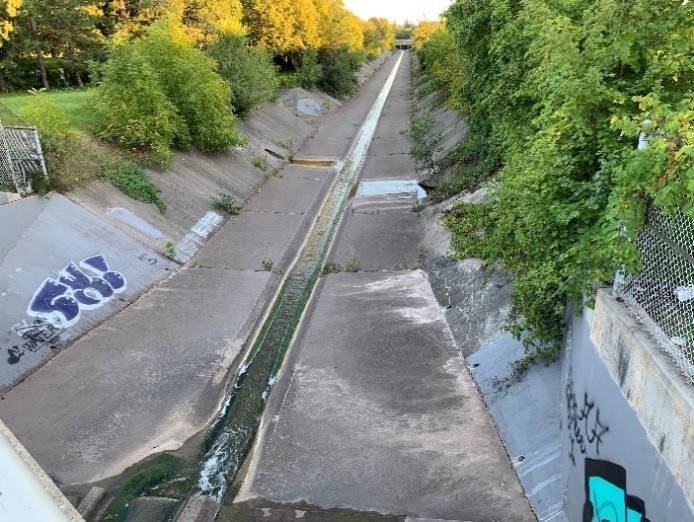
Next, the channel runs between Mapleview Mall and Maple Park. It then goes through a large triple-barrel culvert under the QEW connecting to Indian Creek, where a large energy-dissipation structure was built to avoid damaging Indian Creek during heavy rains (see Figure 6), and flows down Indian Creek’s natural creek bed large enough to carry the increased flow of water safely to the Hamilton Harbour.
At any given time, there is always some water flowing through both Rambo Creek and its diversion channel. During rainfalls, however, the volume of Rambo Creek itself increases only slightly, accommodating more local runoff from the downtown area, but you’ll notice the flow in the channel increases significantly, taking on the majority of the upstream flow from the rains, and saving downtown from severe damage.
Without this amazing, critical, and unassuming piece of infrastructure, Rambo Creek would constantly be trying to erode the banks of our historic Burlington neighborhoods. So next time we get a heavy rainfall in the area, thank the Rambo Creek Diversion Channel and the people who built it for keeping the downtown core safe from being washed away.
Sources:
Conservation Halton. n.d. Dams and Channels. Url: https://www.conservationhalton.ca/dams-and-channels (accessed Sept. 20, 2021).
Wood Environment & Infrastructure Solutions. 2020. Hager-Rambo Flood Control Facilities Study Report – Downtown and Burlington GO Mobility Hub. Report prepared for the City of Burlington. Url: https://www.getinvolvedburlington.ca/9250/widgets/36046/documents/35164 (accessed Sept. 20, 2021).
Eric Chiasson is a civil engineer by training and a construction manager by trade. Having built many infrastructure projects throughout Canada and the United States over the past 25 years, he has become a subject matter expert in infrastructure and construction. Eric is driven by his curiosity to learn more about how things are built and how they work, encouraging others to join the ranks of those who design and build the infrastructure that makes living in our cities possible.